T8 and Red Rains: Hong Kong's Typhoon Signals, Rainstorm Warnings Explained
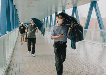
When it comes to tropical cyclones, Hong Kong doesn't take any chances. The Hong Kong Observatory issues tropical cyclone warning signals whenever a storm approaches within 800 kilometres of Hong Kong and poses a threat of deteriorating conditions in the city.
During the summer typhoon season of Hong Kong, typically lasting from June to September, Hong Kongers are frantic to check the status of a typhoon to see whether they can skip school or work. These signals are represented by a set of numbers and symbols and were previously accompanied by lights at night.
History of Hong Kong’s typhoon signals

Hong Kong's residents have been warned of the hazardous wind conditions associated with tropical cyclones since as early as August 1884. At that time, a typhoon gun was placed at the foot of the mast in front of the Tsim Sha Tsui Police Barracks facing Victoria Harbour.
The gun was fired once whenever a strong gale of wind was expected, and twice whenever the wind was expected to blow with typhoon force. Night signals using lanterns were also introduced in late 1890, and by around 1898, the signals were repeated at various locations throughout the city.
In February 1897, Hong Kong introduced the storm signals invented by Admiral Fitzroy in 1861, with a minor modification. A cone pointing upward (North Cone) was hoisted for warning of gales from the north or east, while a cone pointing downwards (South Cone) warned of gales from the south or west.
A drum was added to the cone when a strong gale which might reach hurricane force was expected. The night signal consisted of three lanterns with white or any colour but all alike, hung on a triangular frame, pointing upwards or downwards as the case might be.
Today, these warning signals have evolved to include a range of measures to ensure the safety of Hong Kong's residents and visitors. The history of these signals serves as a reminder of the importance of being prepared in the face of natural disasters.
Hong Kong’s five-level warning system for typhoons

The Hong Kong Observatory uses a five-level definition warning system for tropical cyclones, which is similar to the Saffir-Simpson Hurricane Wind Scale used in the Western Hemisphere. The signals are based on descriptions of winds taken from the Beaufort Scale, a widely recognized tool for measuring wind speed.
The lowest level, No. 1, is an advisory signal that alerts the public that a storm is within about 800 kilometres of Hong Kong and may later affect the city. This signal does not necessarily indicate that there will be strong winds, but it is a precautionary measure to ensure that people are aware of the storm and take necessary preparations. If strong winds are not expected within 24 hours, the issuance of the signal may be delayed until the circulation moves closer or intensifies.
The next signal in the hierarchy is the No. 3 signal, which is a definite warning that a tropical cyclone is expected to come near enough to Hong Kong to cause strong winds in Hong Kong. Strong winds range from 41 to 62 kilometers per hour, but gusts may exceed 110 kilometers per hour (up to 68 miles per hour). The warning refers to the general condition near sea level within Hong Kong, but winds on exposed hilltops and offshore waters may reach gale force.

The No. 8 signal warns of an impending gale or storm from one of the four quadrants. A gale ranges from 63 to 87 kilometres per hour and a storm from 88 to 117 kilometres per hour. Gusts may exceed 180 kilometres per hour (gale: up to 54 miles per hour; storm: up to 72 miles per hour & gust up to 111 miles per hour). The timing of the issuance of the first of these signals is aimed to give about 12 hours of warning of gales generally over Hong Kong near sea level, but the warning may be shorter for exposed areas and on high ground.
The No. 9 signal indicates that the gale or storm is expected to increase significantly in strength. This signal indicates that the centre of a typhoon will soon pass close to Hong Kong, with the consequent shifting of wind direction. Alternatively, the No. 9 signal generally implies that the wind speed has already reached storm force (88 to 117 kilometres per hour) and has a chance of increasing to hurricane force in a short period of time. The signal is not issued for severe tropical storms but may be maintained after a typhoon weakens into a severe tropical storm.
The highest level is Hurricane Signal No. 10, which is issued infrequently, and indicates that a typhoon is approaching Hong Kong or has already hit the city. There have been 16 No. 10 warnings since 1946, of which three have occurred since 2010. When this signal is issued, people are advised to stay indoors and avoid going outside, as hurricane-force winds ranging upwards from 118 kilometres per hour (73 miles per hour) may occur.
Hong Kong’s other rainstorm warnings

Get prepared for Hong Kong's rainy season with our guide to rainstorm warnings. The Hong Kong Observatory (HKO) issues different levels of warnings for heavy rainfall, ranging from Amber to Black. Here's what you need to know:
Amber Warning
If an Amber warning is issued, heavy rain exceeding 30 mL/hr has or is expected to fall, which could lead to flooding in low-lying areas. To stay safe, attend public examinations as normal, avoid bodies of water that may flood, and keep an eye out for heightened warnings.
Red Warning
If a Red warning is issued, heavy rainfall exceeding 50 mL/hr has or is expected to fall, which can cause serious flooding, river overflow, and traffic jams. If your job requires you to be outside, stop working and find indoor work if transportation is running normally and it’s safe to do so.

Black Warning
If a Black warning is issued, very heavy rainfall exceeding 70mL/hr has or is expected to fall. Stay indoors until the rain has passed, stop working and find shelter if you’re required to be outside, stay at work if it’s safer than returning home, or go to a temporary shelter operated by the Home Affairs Department if you have nowhere safe to go. Call the emergency hotline at 2835 1473 to find the shelter nearest to you.
Strong Monsoon Signal
The Strong Monsoon Signal is issued when monsoon winds are at or exceeding 40km/h near sea level. During the winter monsoon from October to March, bring objects likely to be blown away indoors, stay away from the shoreline as rough swells may affect the coast, and be aware of strong winds on freeways if you’re driving.
Get the latest curated content with The Beat Asia's newsletters. Sign up now for a weekly dose of the best stories, events, and deals delivered straight to your inbox. Don't miss out! Click here to subscribe.


